
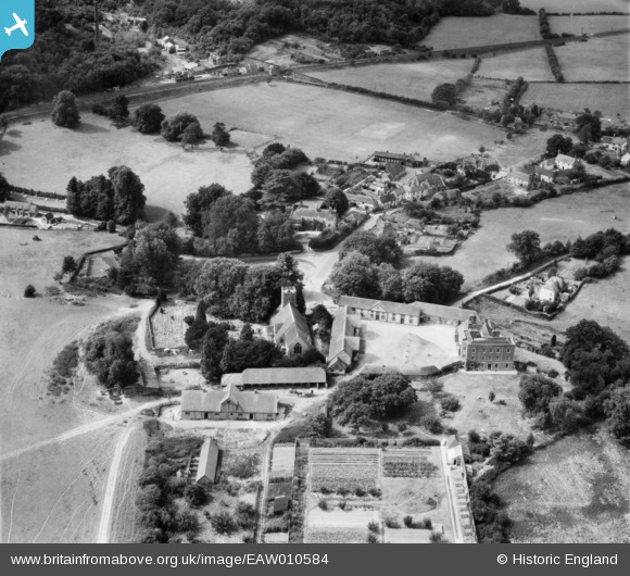
EAW010584 ENGLAND (1947). St Mary's Church, the Manor House and the village, Buriton, 1947
© Copyright OpenStreetMap contributors and licensed by the OpenStreetMap Foundation. 2024. Cartography is licensed as CC BY-SA.
Nearby Images (8)
EAW010584

EAW010588

EAW010587

EAW010585

EAW010586

EAW010583

EAW010589

EAW010590

Details
| Title | [EAW010584] St Mary's Church, the Manor House and the village, Buriton, 1947 |
| Reference | EAW010584 |
| Date | 3-September-1947 |
| Link | |
| Place name | BURITON |
| Parish | BURITON |
| District | |
| Country | ENGLAND |
| Easting / Northing | 473941, 120039 |
| Longitude / Latitude | -0.94671775606489, 50.974467512243 |
| National Grid Reference | SU739200 |
Pins
 totoro |
Friday 7th of August 2015 07:31:22 PM | |
totoro |
Friday 7th of August 2015 07:30:21 PM | |
totoro |
Friday 7th of August 2015 07:29:36 PM | |
totoro |
Friday 7th of August 2015 07:28:13 PM | |
totoro |
Friday 7th of August 2015 07:26:48 PM | |
totoro |
Friday 7th of August 2015 07:25:25 PM | |
totoro |
Friday 7th of August 2015 07:23:51 PM |


