
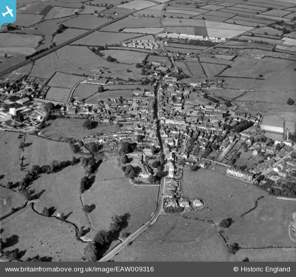
EAW009316 ENGLAND (1947). The town, Wigton, 1947
© Copyright OpenStreetMap contributors and licensed by the OpenStreetMap Foundation. 2024. Cartography is licensed as CC BY-SA.
Nearby Images (9)
EAW009316

EPW029200

EPW029206

EPW029204

EPW029205

EAW009315

EPW029202

EPW029203

EAW009313

Details
| Title | [EAW009316] The town, Wigton, 1947 |
| Reference | EAW009316 |
| Date | 11-August-1947 |
| Link | |
| Place name | WIGTON |
| Parish | WIGTON |
| District | |
| Country | ENGLAND |
| Easting / Northing | 325431, 548379 |
| Longitude / Latitude | -3.160795052461, 54.824602126768 |
| National Grid Reference | NY254484 |
Pins
 Waldemar |
Tuesday 6th of October 2020 12:33:13 PM | |
Waldemar |
Tuesday 6th of October 2020 12:29:42 PM | |
Waldemar |
Tuesday 6th of October 2020 12:28:10 PM | |
Waldemar |
Tuesday 6th of October 2020 12:26:54 PM | |
Waldemar |
Tuesday 6th of October 2020 12:25:39 PM | |
Waldemar |
Tuesday 6th of October 2020 12:23:47 PM |


