
Scheduled Maintenance
This website will undergo scheduled maintenance on Tuesday, September 10th, between 11:00 and 15:00, as well as on Thursday, September 12th, between 10:00 and 12:00. During this time, services may be temporarily disrupted. We apologise for any inconvenience.
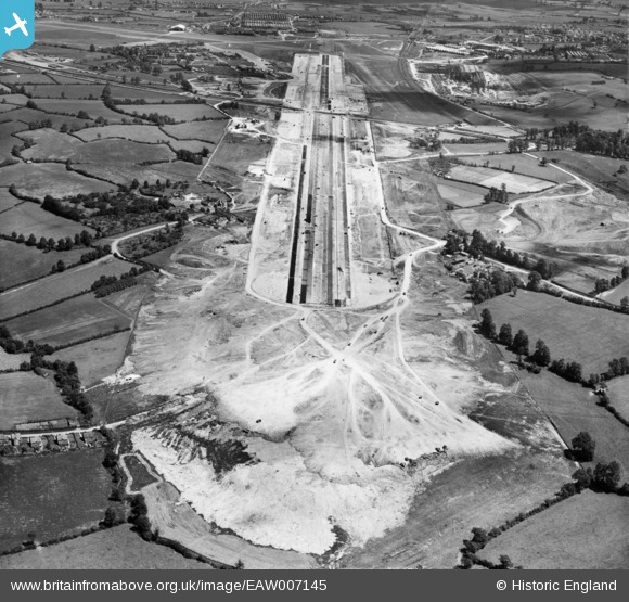
EAW007145 ENGLAND (1947). Bristol Filton Airport under construction, Catbrain, from the west, 1947
© Copyright OpenStreetMap contributors and licensed by the OpenStreetMap Foundation. 2024. Cartography is licensed as CC BY-SA.
Nearby Images (28)
EAW007145

EAW009953

EAW001555

EAW007131

EAW007138

EAW003557

EAW001552

EAW027786

EAW004181

EAW009955

EAW009951

EAW027776

EAW009952

EAW027778

EAW001549

EAW027774

EAW004184

EAW027780

EAW027777

EAW009950

EAW003549

EAW013922

EAW027775

EAW027787

EAW007136

EAW027783

EAW027773

EAW027779

Details
| Title | [EAW007145] Bristol Filton Airport under construction, Catbrain, from the west, 1947 |
| Reference | EAW007145 |
| Date | 11-June-1947 |
| Link | |
| Place name | CATBRAIN |
| Parish | ALMONDSBURY |
| District | |
| Country | ENGLAND |
| Easting / Northing | 357697, 180230 |
| Longitude / Latitude | -2.6097550685696, 51.518922664628 |
| National Grid Reference | ST577802 |
