
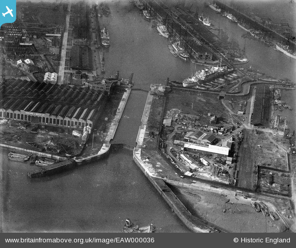
EAW000036 ENGLAND (1946). The entrance to the King George V Dock, Beckton, 1946
© Copyright OpenStreetMap contributors and licensed by the OpenStreetMap Foundation. 2024. Cartography is licensed as CC BY-SA.
Nearby Images (26)
EAW000036

EPW044115

EAW029488

EAW029489

EAW008729

EAW008736

EAW008731

EAW008737

EAW049352

EAW008733

EAW008738

EAW008735

EAW008748

EAW046497

EPW044125

EAW008734

EPW044126

EPW032929

EAW008730

EAW008732

EPW032931

EPW008553

EPW044122

EPW024897

EPW024898

EPW044121

Details
| Title | [EAW000036] The entrance to the King George V Dock, Beckton, 1946 |
| Reference | EAW000036 |
| Date | 24-February-1946 |
| Link | |
| Place name | BECKTON |
| Parish | |
| District | |
| Country | ENGLAND |
| Easting / Northing | 543960, 180219 |
| Longitude / Latitude | 0.07436526568396, 51.502064272668 |
| National Grid Reference | TQ440802 |
Pins
 Matt Aldred edob.mattaldred.com |
Sunday 22nd of November 2020 08:13:33 PM | |
 redmist |
Saturday 4th of July 2020 11:00:51 PM | |
redmist |
Saturday 4th of July 2020 11:00:09 PM | |
redmist |
Saturday 4th of July 2020 10:59:26 PM | |
Sparky |
Tuesday 31st of October 2017 11:38:20 PM |


