
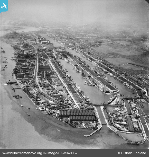
EAW049352 ENGLAND (1953). The Royal Group of Docks, North Woolwich, from the east, 1953
© Copyright OpenStreetMap contributors and licensed by the OpenStreetMap Foundation. 2024. Cartography is licensed as CC BY-SA.
Nearby Images (21)
EAW049352

EAW008734

EAW008738

EAW008748

EAW008733

EAW008735

EAW029489

EPW044126

EPW008553

EAW008736

EAW008737

EAW029488

EAW008732

EAW008729

EAW008730

EAW008731

EPW044115

EAW000036

EPW024257

EAW046497

EAW046499

Details
| Title | [EAW049352] The Royal Group of Docks, North Woolwich, from the east, 1953 |
| Reference | EAW049352 |
| Date | 13-May-1953 |
| Link | |
| Place name | NORTH WOOLWICH |
| Parish | |
| District | |
| Country | ENGLAND |
| Easting / Northing | 543869, 180109 |
| Longitude / Latitude | 0.073010071582279, 51.501098919667 |
| National Grid Reference | TQ439801 |
Pins
 Nowy Paul |
Sunday 18th of November 2018 02:57:40 PM | |
gerry-r |
Monday 30th of June 2014 05:41:45 PM |


