
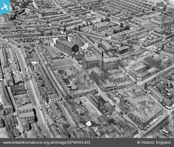
EPW061401 ENGLAND (1939). Pole Street Mill and surrounding streets, Preston, 1939
© Hawlfraint cyfranwyr OpenStreetMap a thrwyddedwyd gan yr OpenStreetMap Foundation. 2024. Trwyddedir y gartograffeg fel CC BY-SA.
Delweddau cyfagos (11)
EPW061401

EPW061403

EPW061406

EPW061400

EAW023380

EAW023381
 and environs, Preston, 1949")
EAW015902

EPW061404

EAW015909

EPW061405

EPW061402

Manylion
| Pennawd | [EPW061401] Pole Street Mill and surrounding streets, Preston, 1939 |
| Cyfeirnod | EPW061401 |
| Dyddiad | 2-June-1939 |
| Dolen | |
| Enw lle | PRESTON |
| Plwyf | |
| Ardal | |
| Gwlad | ENGLAND |
| Dwyreiniad / Gogleddiad | 354306, 429608 |
| Hydred / Lledred | -2.6931922965086, 53.760602085597 |
| Cyfeirnod Grid Cenedlaethol | SD543296 |
Pinnau
 Robert - Cumbria |
Thursday 6th of February 2014 10:02:31 PM | |
Robert - Cumbria |
Thursday 6th of February 2014 09:59:27 PM | |
Robert - Cumbria |
Thursday 6th of February 2014 09:58:51 PM | |
Robert - Cumbria |
Thursday 6th of February 2014 09:45:35 PM | |
Robert - Cumbria |
Thursday 6th of February 2014 09:43:02 PM | |
Robert - Cumbria |
Thursday 6th of February 2014 09:42:24 PM | |
Robert - Cumbria |
Thursday 6th of February 2014 09:40:58 PM | |
Robert - Cumbria |
Thursday 6th of February 2014 09:35:32 PM | |
Robert - Cumbria |
Thursday 6th of February 2014 09:29:13 PM | |
Robert - Cumbria |
Thursday 6th of February 2014 09:28:29 PM | |
Robert - Cumbria |
Thursday 6th of February 2014 09:27:44 PM |


