
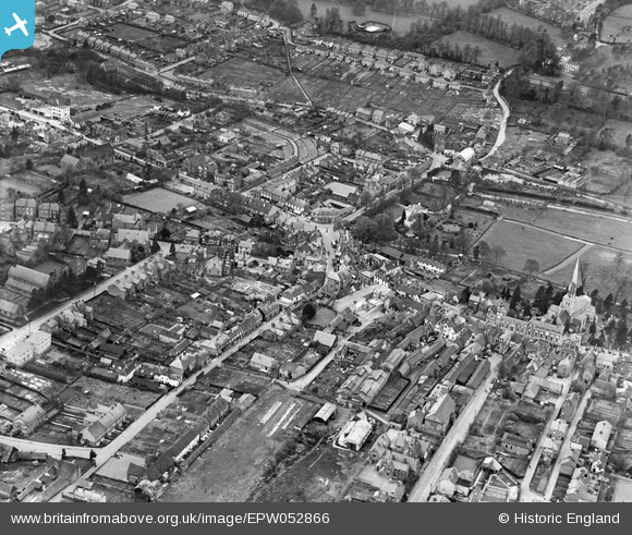
EPW052866 ENGLAND (1937). The Junction of Marlowes and Bury Road (Queensway) and environs, Hemel Hempstead, 1937
© Hawlfraint cyfranwyr OpenStreetMap a thrwyddedwyd gan yr OpenStreetMap Foundation. 2024. Trwyddedir y gartograffeg fel CC BY-SA.
Delweddau cyfagos (23)
EPW052866
 and environs, Hemel Hempstead, 1937")
EAW014883

EPW052865
, Hemel Hempstead, 1937")
EPW022457

EPW017818

EAW014884

EPW017820

EAW017252

EAW017251

EAW017250

EAW017256

EAW017260

EPW017817

EAW014881

EPR000482

EAW014882

EAW017255

EAW017257

EAW017261

EAW017253

EPW052869

EPW022456

EAW017254

Manylion
| Pennawd | [EPW052866] The Junction of Marlowes and Bury Road (Queensway) and environs, Hemel Hempstead, 1937 |
| Cyfeirnod | EPW052866 |
| Dyddiad | 16-April-1937 |
| Dolen | |
| Enw lle | HEMEL HEMPSTEAD |
| Plwyf | |
| Ardal | |
| Gwlad | ENGLAND |
| Dwyreiniad / Gogleddiad | 505561, 207652 |
| Hydred / Lledred | -0.47041599227611, 51.757141540603 |
| Cyfeirnod Grid Cenedlaethol | TL056077 |
Pinnau
 OldBill |
Wednesday 27th of May 2020 08:18:09 PM | |
OldBill |
Wednesday 27th of May 2020 08:17:26 PM | |
OldBill |
Sunday 23rd of September 2018 05:28:38 PM | |
H.E. |
Monday 26th of February 2018 10:36:07 PM | |
H.E. |
Monday 26th of February 2018 10:30:17 PM |


