
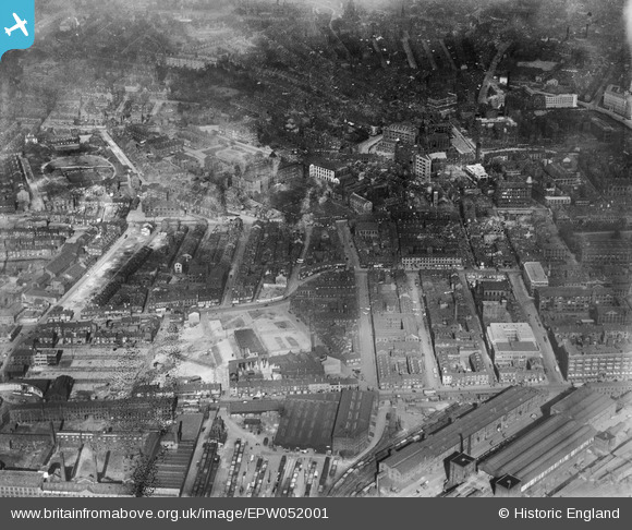
EPW052001 ENGLAND (1936). West Street and environs showing building clearance in advance of new road construction, Leeds, 1936. This image has been produced from a damaged negative.
© Hawlfraint cyfranwyr OpenStreetMap a thrwyddedwyd gan yr OpenStreetMap Foundation. 2024. Trwyddedir y gartograffeg fel CC BY-SA.
Delweddau cyfagos (13)
EPW052001

EPW052002

EPW052005

EPW052006

EPW052007

EPW052003

EPW052004

EPW052016

EPW052014

EPW052015

EPW052018

EPW052017

EAW015742

Manylion
| Pennawd | [EPW052001] West Street and environs showing building clearance in advance of new road construction, Leeds, 1936. This image has been produced from a damaged negative. |
| Cyfeirnod | EPW052001 |
| Dyddiad | October-1936 |
| Dolen | |
| Enw lle | LEEDS |
| Plwyf | |
| Ardal | |
| Gwlad | ENGLAND |
| Dwyreiniad / Gogleddiad | 429312, 433752 |
| Hydred / Lledred | -1.5549232531318, 53.799030921918 |
| Cyfeirnod Grid Cenedlaethol | SE293338 |
Pinnau
Byddwch y cyntaf i ychwanegu sylw at y ddelwedd hon!


