
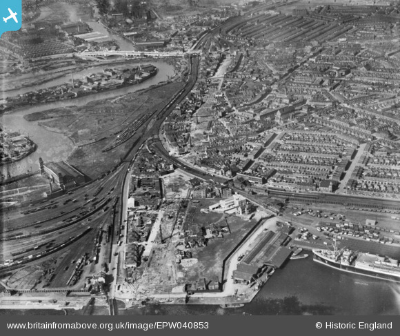
EPW040853 ENGLAND (1933). Slum clearance off the Victoria Dock Road and environs, Canning Town, 1933
© Hawlfraint cyfranwyr OpenStreetMap a thrwyddedwyd gan yr OpenStreetMap Foundation. 2024. Trwyddedir y gartograffeg fel CC BY-SA.
Delweddau cyfagos (6)
EPW040853

EPW059455

EPW040854

EPW059453

EPW059407

EPW046798

Manylion
| Pennawd | [EPW040853] Slum clearance off the Victoria Dock Road and environs, Canning Town, 1933 |
| Cyfeirnod | EPW040853 |
| Dyddiad | March-1933 |
| Dolen | |
| Enw lle | CANNING TOWN |
| Plwyf | |
| Ardal | |
| Gwlad | ENGLAND |
| Dwyreiniad / Gogleddiad | 539811, 180893 |
| Hydred / Lledred | 0.01488859696189, 51.509163195545 |
| Cyfeirnod Grid Cenedlaethol | TQ398809 |
Pinnau
 John W |
Saturday 4th of February 2017 05:42:56 PM | |
 Class31 |
Saturday 28th of February 2015 08:13:10 AM |


