
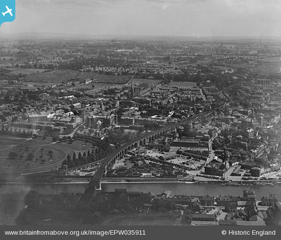
EPW035911 ENGLAND (1931). Worcester Viaduct and the city, Worcester, from the south-west, 1931
© Hawlfraint cyfranwyr OpenStreetMap a thrwyddedwyd gan yr OpenStreetMap Foundation. 2024. Trwyddedir y gartograffeg fel CC BY-SA.
Delweddau cyfagos (5)
EPW035911

EPW001304

EPW005383

EAW046114

EPW005384

Manylion
| Pennawd | [EPW035911] Worcester Viaduct and the city, Worcester, from the south-west, 1931 |
| Cyfeirnod | EPW035911 |
| Dyddiad | 3-July-1931 |
| Dolen | |
| Enw lle | WORCESTER |
| Plwyf | |
| Ardal | |
| Gwlad | ENGLAND |
| Dwyreiniad / Gogleddiad | 384502, 255050 |
| Hydred / Lledred | -2.2267506594128, 52.193067833759 |
| Cyfeirnod Grid Cenedlaethol | SO845551 |
