
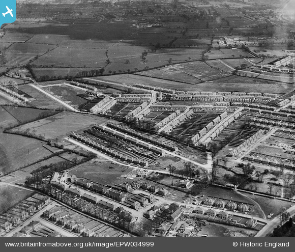
EPW034999 ENGLAND (1931). Residential development around Glenalmond Road and D'Arcy Gardens, Kenton, 1931
© Hawlfraint cyfranwyr OpenStreetMap a thrwyddedwyd gan yr OpenStreetMap Foundation. 2024. Trwyddedir y gartograffeg fel CC BY-SA.
Delweddau cyfagos (4)
EPW034999

EAW044761

EPW035000

EPW035000
Manylion
| Pennawd | [EPW034999] Residential development around Glenalmond Road and D'Arcy Gardens, Kenton, 1931 |
| Cyfeirnod | EPW034999 |
| Dyddiad | April-1931 |
| Dolen | |
| Enw lle | KENTON |
| Plwyf | |
| Ardal | |
| Gwlad | ENGLAND |
| Dwyreiniad / Gogleddiad | 518185, 189351 |
| Hydred / Lledred | -0.29377057565123, 51.590125826572 |
| Cyfeirnod Grid Cenedlaethol | TQ182894 |
Pinnau
 mike |
Monday 22nd of November 2021 04:00:57 PM | |
mike |
Monday 22nd of November 2021 04:00:05 PM | |
trueglory |
Friday 29th of November 2019 11:52:07 PM | |
The Laird |
Thursday 29th of March 2018 03:39:35 PM | |
The Laird |
Thursday 29th of March 2018 03:28:44 PM | |
The Laird |
Thursday 29th of March 2018 03:04:23 PM | |
csunderland |
Wednesday 16th of September 2015 10:48:39 AM | |
csunderland |
Wednesday 16th of September 2015 10:47:55 AM | |
csunderland |
Wednesday 16th of September 2015 10:46:25 AM | |
csunderland |
Wednesday 16th of September 2015 10:45:46 AM |


