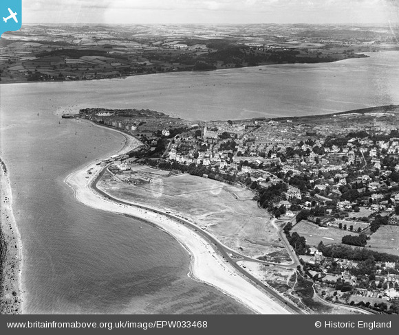
EPW033468 ENGLAND (1930). The Maer, the town and the River Exe, Exmouth, from the south-east, 1930
© Hawlfraint cyfranwyr OpenStreetMap a thrwyddedwyd gan yr OpenStreetMap Foundation. 2024. Trwyddedir y gartograffeg fel CC BY-SA.
Delweddau cyfagos (2)
EPW033468

EPW039697

Manylion
| Pennawd | [EPW033468] The Maer, the town and the River Exe, Exmouth, from the south-east, 1930 |
| Cyfeirnod | EPW033468 |
| Dyddiad | July-1930 |
| Dolen | |
| Enw lle | EXMOUTH |
| Plwyf | EXMOUTH |
| Ardal | |
| Gwlad | ENGLAND |
| Dwyreiniad / Gogleddiad | 300958, 80037 |
| Hydred / Lledred | -3.399956194623, 50.611043306858 |
| Cyfeirnod Grid Cenedlaethol | SY010800 |
Pinnau
 John Llewellyn |
Wednesday 24th of June 2020 02:41:04 PM | |
ElTel |
Saturday 15th of November 2014 01:37:40 AM | |
 Class31 |
Wednesday 19th of June 2013 10:22:44 PM | |
Class31 |
Wednesday 19th of June 2013 10:20:32 PM |