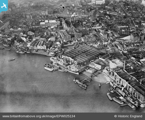
EPW025134 ENGLAND (1928). Limekiln Dock and surrounding warehouses, Limehouse, 1928. This image has been produced from a copy-negative.
© Hawlfraint cyfranwyr OpenStreetMap a thrwyddedwyd gan yr OpenStreetMap Foundation. 2024. Trwyddedir y gartograffeg fel CC BY-SA.
Delweddau cyfagos (19)
EPW025134

EAW048410

EAW048410
EAW048417

EAW048417
EAW048416

EAW048420

EAW048413

EPW025135

EAW048411

EAW048411
EAW048415

EAW048412

EAW048419

EAW048418

EAW048418
EAW048414

EPW060798

EPW010938

Manylion
| Pennawd | [EPW025134] Limekiln Dock and surrounding warehouses, Limehouse, 1928. This image has been produced from a copy-negative. |
| Cyfeirnod | EPW025134 |
| Dyddiad | 23-October-1928 |
| Dolen | |
| Enw lle | LIMEHOUSE |
| Plwyf | |
| Ardal | |
| Gwlad | ENGLAND |
| Dwyreiniad / Gogleddiad | 536743, 180602 |
| Hydred / Lledred | -0.029410357558912, 51.507298842947 |
| Cyfeirnod Grid Cenedlaethol | TQ367806 |
Pinnau
 Grollo |
Monday 23rd of October 2023 04:16:41 PM | |
Grollo |
Monday 23rd of October 2023 04:15:27 PM | |
moses72 |
Monday 2nd of November 2015 11:09:11 AM | |
moses72 |
Monday 2nd of November 2015 11:04:46 AM | |
moses72 |
Monday 2nd of November 2015 10:59:18 AM | |
moses72 |
Monday 2nd of November 2015 10:42:28 AM | |
 Class31 |
Monday 30th of March 2015 08:10:24 AM |