
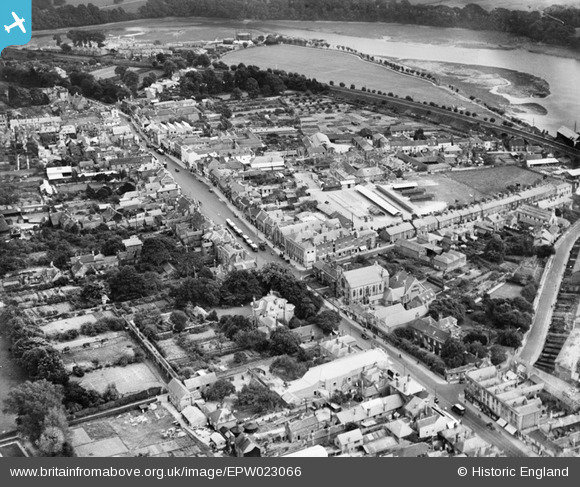
EPW023066 ENGLAND (1928). The town centre, Fareham, 1928
© Hawlfraint cyfranwyr OpenStreetMap a thrwyddedwyd gan yr OpenStreetMap Foundation. 2024. Trwyddedir y gartograffeg fel CC BY-SA.
Delweddau cyfagos (3)
EPW023066

EPW023073

EPW023074

Manylion
| Pennawd | [EPW023066] The town centre, Fareham, 1928 |
| Cyfeirnod | EPW023066 |
| Dyddiad | August-1928 |
| Dolen | |
| Enw lle | FAREHAM |
| Plwyf | |
| Ardal | |
| Gwlad | ENGLAND |
| Dwyreiniad / Gogleddiad | 457946, 106187 |
| Hydred / Lledred | -1.176736857281, 50.851735824671 |
| Cyfeirnod Grid Cenedlaethol | SU579062 |
Pinnau
 Penllanafal |
Monday 20th of November 2023 09:42:30 AM | |
Vicar |
Thursday 29th of November 2018 01:54:29 PM | |
Vicar |
Thursday 29th of November 2018 01:53:45 PM | |
Vicar |
Thursday 29th of November 2018 12:25:09 PM | |
Vicar |
Thursday 29th of November 2018 12:23:43 PM | |
Vicar |
Thursday 29th of November 2018 12:22:40 PM | |
Vicar |
Thursday 29th of November 2018 12:21:36 PM | |
Vicar |
Thursday 29th of November 2018 12:20:35 PM | |
 Class31 |
Tuesday 21st of October 2014 08:16:10 AM | |
Parmelia |
Thursday 20th of February 2014 11:37:43 PM | |
Mykiemike |
Wednesday 28th of August 2013 09:10:54 PM | |
Mykiemike |
Wednesday 28th of August 2013 09:04:43 PM | |
Mykiemike |
Wednesday 28th of August 2013 08:57:01 PM | |
Mykiemike |
Wednesday 28th of August 2013 08:40:28 PM | |
Mykiemike |
Wednesday 28th of August 2013 08:38:27 PM | |
Mykiemike |
Wednesday 28th of August 2013 08:37:39 PM |
Cyfraniadau Grŵp
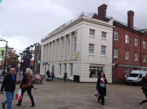
 Westbury Manor, Fareham, 16/10/2014 |
Class31 |
Monday 20th of October 2014 10:59:05 PM |


