
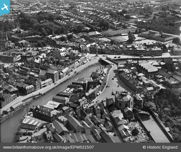
EPW021507 ENGLAND (1928). Wisbech Bridge and the Old Market, Wisbech, 1928
© Hawlfraint cyfranwyr OpenStreetMap a thrwyddedwyd gan yr OpenStreetMap Foundation. 2024. Trwyddedir y gartograffeg fel CC BY-SA.
Delweddau cyfagos (7)
EPW021507

EPW021500

EPW039188

EPW021503

EPW039184

EPW021501

EPW021504

Manylion
| Pennawd | [EPW021507] Wisbech Bridge and the Old Market, Wisbech, 1928 |
| Cyfeirnod | EPW021507 |
| Dyddiad | June-1928 |
| Dolen | |
| Enw lle | WISBECH |
| Plwyf | WISBECH |
| Ardal | |
| Gwlad | ENGLAND |
| Dwyreiniad / Gogleddiad | 546047, 309682 |
| Hydred / Lledred | 0.15987625079265, 52.664803595099 |
| Cyfeirnod Grid Cenedlaethol | TF460097 |
Pinnau
 Peter |
Friday 31st of January 2014 07:23:57 PM | |
Peter |
Sunday 26th of January 2014 08:34:40 AM | |
Peter |
Sunday 26th of January 2014 08:22:28 AM | |
Peter |
Tuesday 5th of February 2013 08:13:56 PM | |
Peter |
Tuesday 5th of February 2013 08:12:54 PM | |
Peter |
Tuesday 5th of February 2013 08:11:08 PM | |
Peter |
Friday 1st of February 2013 07:31:07 PM | |
Peter |
Friday 1st of February 2013 07:27:39 PM | |
Peter |
Friday 1st of February 2013 07:26:05 PM |