
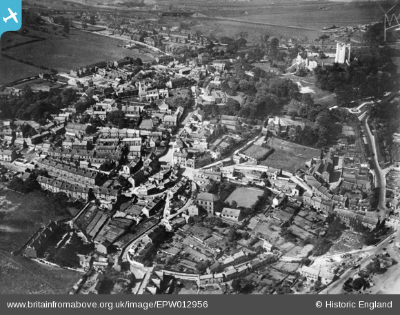
EPW012956 ENGLAND (1925). The town centre, Conisbrough, 1925. This image has been produced from a copy-negative.
© Hawlfraint cyfranwyr OpenStreetMap a thrwyddedwyd gan yr OpenStreetMap Foundation. 2024. Trwyddedir y gartograffeg fel CC BY-SA.
Delweddau cyfagos (4)
EPW012956

EPW014867

EPW015389

EPW014865

Manylion
| Pennawd | [EPW012956] The town centre, Conisbrough, 1925. This image has been produced from a copy-negative. |
| Cyfeirnod | EPW012956 |
| Dyddiad | June-1925 |
| Dolen | |
| Enw lle | CONISBROUGH |
| Plwyf | |
| Ardal | |
| Gwlad | ENGLAND |
| Dwyreiniad / Gogleddiad | 451256, 398606 |
| Hydred / Lledred | -1.2275431879138, 53.481424399626 |
| Cyfeirnod Grid Cenedlaethol | SK513986 |
Pinnau
 MB |
Friday 22nd of January 2021 01:54:00 PM |


