
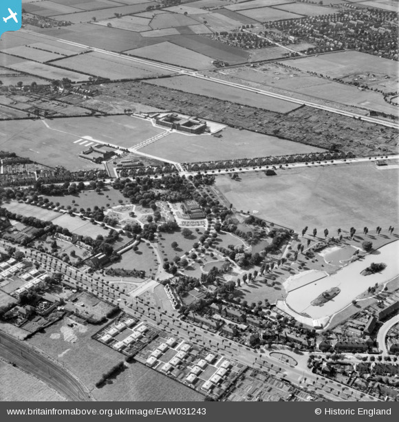
EAW031243 ENGLAND (1950). Pickering Park, Kingston upon Hull, 1950
© Hawlfraint cyfranwyr OpenStreetMap a thrwyddedwyd gan yr OpenStreetMap Foundation. 2024. Trwyddedir y gartograffeg fel CC BY-SA.
Delweddau cyfagos (7)
EAW031243

EPW036569

EPW036393

EPW036567

EAW031242

EPW036562

EPW036548

Manylion
| Pennawd | [EAW031243] Pickering Park, Kingston upon Hull, 1950 |
| Cyfeirnod | EAW031243 |
| Dyddiad | 25-July-1950 |
| Dolen | |
| Enw lle | KINGSTON UPON HULL |
| Plwyf | |
| Ardal | |
| Gwlad | ENGLAND |
| Dwyreiniad / Gogleddiad | 505543, 427359 |
| Hydred / Lledred | -0.39992718353598, 53.7317076978 |
| Cyfeirnod Grid Cenedlaethol | TA055274 |
Pinnau
 Matt Aldred edob.mattaldred.com |
Wednesday 31st of March 2021 01:08:49 PM | |
 john |
Saturday 6th of October 2018 08:46:31 PM | |
john |
Saturday 6th of October 2018 08:45:22 PM | |
Sparky |
Tuesday 5th of September 2017 11:30:32 AM | |
tiv |
Monday 28th of November 2016 08:46:45 PM | |
John Wass |
Wednesday 24th of September 2014 03:34:44 PM | |
4 x 4.5" Anti Aircraft Guns replaced by the later battery to the north east. |
tiv |
Monday 28th of November 2016 08:45:07 PM |


