
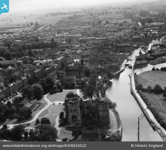
EAW016512 ENGLAND (1948). Newark Castle, the River Trent and the town, Newark-on-Trent, from the north-east, 1948. This image has been produced from a print.
© Hawlfraint cyfranwyr OpenStreetMap a thrwyddedwyd gan yr OpenStreetMap Foundation. 2024. Trwyddedir y gartograffeg fel CC BY-SA.
Delweddau cyfagos (20)
EAW016512

EAW006307

EAW006303

EAW006308

EPW015267

EAW006304

EPW013025

EAW013673

EPW015268

EAW016508

EAW013672

EAW016511

EAW006306

EPW016193

EAW016510

EAW006301

EAW016509

EAW013675

EPW015269

EPW015270

Manylion
| Pennawd | [EAW016512] Newark Castle, the River Trent and the town, Newark-on-Trent, from the north-east, 1948. This image has been produced from a print. |
| Cyfeirnod | EAW016512 |
| Dyddiad | 9-November-1948 |
| Dolen | |
| Enw lle | NEWARK-ON-TRENT |
| Plwyf | NEWARK |
| Ardal | |
| Gwlad | ENGLAND |
| Dwyreiniad / Gogleddiad | 479659, 354067 |
| Hydred / Lledred | -0.81074420616575, 53.077582367888 |
| Cyfeirnod Grid Cenedlaethol | SK797541 |
Pinnau
 John Wass |
Sunday 28th of September 2014 08:48:30 PM |