
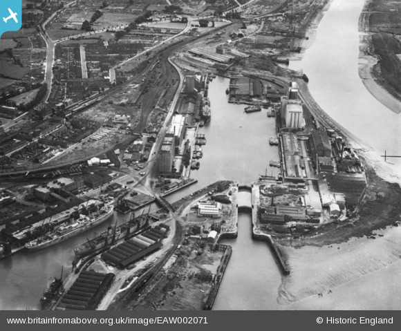
EAW002071 ENGLAND (1946). Avonmouth Docks, Avonmouth, 1946. This image has been produced from a print.
© Hawlfraint cyfranwyr OpenStreetMap a thrwyddedwyd gan yr OpenStreetMap Foundation. 2024. Trwyddedir y gartograffeg fel CC BY-SA.
Delweddau cyfagos (17)
EAW002071

EPW005487

EPW027951

EPR000058

EPW027954

EPR000059

EPW005488

EPW046970

EPW014691

EPW043043

EPW043044

EPW008649

EPR000061

EPW008651

EPW005513

EPW027946

EAW002253

Manylion
| Pennawd | [EAW002071] Avonmouth Docks, Avonmouth, 1946. This image has been produced from a print. |
| Cyfeirnod | EAW002071 |
| Dyddiad | 31-July-1946 |
| Dolen | |
| Enw lle | AVONMOUTH |
| Plwyf | |
| Ardal | |
| Gwlad | ENGLAND |
| Dwyreiniad / Gogleddiad | 351214, 178054 |
| Hydred / Lledred | -2.7028927510429, 51.498833597317 |
| Cyfeirnod Grid Cenedlaethol | ST512781 |
Pinnau
 redmist |
Tuesday 10th of November 2020 11:26:12 PM | |
redmist |
Tuesday 10th of November 2020 11:21:34 PM | |
redmist |
Tuesday 10th of November 2020 11:21:03 PM | |
Sparky |
Wednesday 13th of September 2017 07:07:49 PM | |
Sparky |
Wednesday 13th of September 2017 07:04:10 PM |