
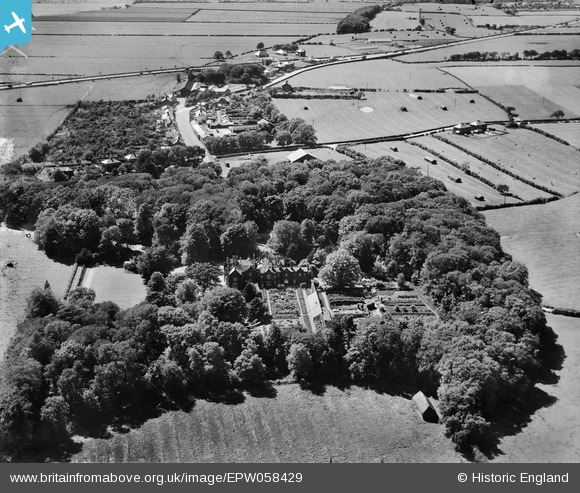
epw058429 ENGLAND (1938). Clifton Hall, Clifton, 1938
© Copyright OpenStreetMap contributors and licensed by the OpenStreetMap Foundation. 2026. Cartography is licensed as CC BY-SA.
Nearby Images (8)
EPW058429

EPW058430

EPW058432

EPW058434

EPW058431

EPW058433

EPW058436

EPW058435

Details
| Title | [EPW058429] Clifton Hall, Clifton, 1938 |
| Reference | EPW058429 |
| Date | 26-July-1938 |
| Link | |
| Place name | CLIFTON |
| Parish | NEWTON-WITH-CLIFTON |
| District | |
| Country | ENGLAND |
| Easting / Northing | 346949, 430370 |
| Longitude / Latitude | -2.8049199908593, 53.766753826745 |
| National Grid Reference | SD469304 |
Pins

totoro |
Saturday 9th of November 2013 12:55:30 PM | |
|
totoro |
Saturday 9th of November 2013 12:49:50 PM | |
|
totoro |
Saturday 9th of November 2013 12:48:20 PM | |
|
totoro |
Saturday 9th of November 2013 12:45:40 PM | |
|
totoro |
Saturday 9th of November 2013 12:45:06 PM | |
|
totoro |
Saturday 9th of November 2013 12:44:41 PM | |
|
totoro |
Saturday 9th of November 2013 12:44:20 PM |
User Comment Contributions
This view is looking towards the West |
totoro |
Saturday 9th of November 2013 12:43:31 PM |