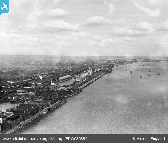
epw036384 ENGLAND (1931). The Albert Dock, the William Wright Dock and the River Humber, Kingston upon Hull, from the south, 1931
© Copyright OpenStreetMap contributors and licensed by the OpenStreetMap Foundation. 2024. Cartography is licensed as CC BY-SA.
Nearby Images (5)
Details
| Title | [EPW036384] The Albert Dock, the William Wright Dock and the River Humber, Kingston upon Hull, from the south, 1931 |
| Reference | EPW036384 |
| Date | August-1931 |
| Link | |
| Place name | KINGSTON UPON HULL |
| Parish | |
| District | |
| Country | ENGLAND |
| Easting / Northing | 508137, 427102 |
| Longitude / Latitude | -0.36070849924635, 53.728867043756 |
| National Grid Reference | TA081271 |
Pins
 John Wass |
Tuesday 19th of August 2014 03:09:22 PM |


![[EPW036384] The Albert Dock, the William Wright Dock and the River Humber, Kingston upon Hull, from the south, 1931](http://britainfromabove.org.uk/sites/all/libraries/aerofilms-images/public/100x100/EPW/036/EPW036384.jpg)
![[EPW036377] The William Wright Dock, the Albert Dock and the River Humber, Kingston upon Hull, from the south, 1931](http://britainfromabove.org.uk/sites/all/libraries/aerofilms-images/public/100x100/EPW/036/EPW036377.jpg)
![[EPW036420] St Andrew's Dock, boats on the River Humber and environs, Kingston upon Hull, from the east, 1931](http://britainfromabove.org.uk/sites/all/libraries/aerofilms-images/public/100x100/EPW/036/EPW036420.jpg)
![[EAW046148] Albert Dock West Junction and environs, Kingston upon Hull, from the south-east, 1952](http://britainfromabove.org.uk/sites/all/libraries/aerofilms-images/public/100x100/EAW/046/EAW046148.jpg)
![[EPW055049] William Wright Dock and Albert Dock, Kingston upon Hull, from the south-west, 1937. This image has been produced from a print.](http://britainfromabove.org.uk/sites/all/libraries/aerofilms-images/public/100x100/EPW/055/EPW055049.jpg)