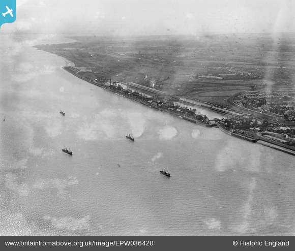
EPW036420 ENGLAND (1931). St Andrew's Dock, boats on the River Humber and environs, Kingston upon Hull, from the east, 1931
© Copyright OpenStreetMap contributors and licensed by the OpenStreetMap Foundation. 2026. Cartography is licensed as CC BY-SA.
Nearby Images (5)
Details
| Title | [EPW036420] St Andrew's Dock, boats on the River Humber and environs, Kingston upon Hull, from the east, 1931 |
| Reference | EPW036420 |
| Date | August-1931 |
| Link | |
| Place name | KINGSTON UPON HULL |
| Parish | |
| District | |
| Country | ENGLAND |
| Easting / Northing | 508048, 426974 |
| Longitude / Latitude | -0.36210179141934, 53.727735351388 |
| National Grid Reference | TA080270 |
Pins
Be the first to add a comment to this image!


![[EPW036420] St Andrew's Dock, boats on the River Humber and environs, Kingston upon Hull, from the east, 1931](http://britainfromabove.org.uk/sites/all/libraries/aerofilms-images/public/100x100/EPW/036/EPW036420.jpg)
![[EPW036377] The William Wright Dock, the Albert Dock and the River Humber, Kingston upon Hull, from the south, 1931](http://britainfromabove.org.uk/sites/all/libraries/aerofilms-images/public/100x100/EPW/036/EPW036377.jpg)
![[EPW036384] The Albert Dock, the William Wright Dock and the River Humber, Kingston upon Hull, from the south, 1931](http://britainfromabove.org.uk/sites/all/libraries/aerofilms-images/public/100x100/EPW/036/EPW036384.jpg)
![[EAW046148] Albert Dock West Junction and environs, Kingston upon Hull, from the south-east, 1952](http://britainfromabove.org.uk/sites/all/libraries/aerofilms-images/public/100x100/EAW/046/EAW046148.jpg)
![[EPW055049] William Wright Dock and Albert Dock, Kingston upon Hull, from the south-west, 1937. This image has been produced from a print.](http://britainfromabove.org.uk/sites/all/libraries/aerofilms-images/public/100x100/EPW/055/EPW055049.jpg)