
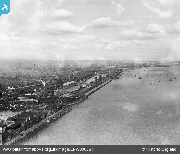
EPW036384 ENGLAND (1931). The Albert Dock, the William Wright Dock and the River Humber, Kingston upon Hull, from the south, 1931
© Copyright OpenStreetMap contributors and licensed by the OpenStreetMap Foundation. 2026. Cartography is licensed as CC BY-SA.
Nearby Images (5)
EPW036384

EPW036377

EPW036420

EAW046148

EPW055049

Details
| Title | [EPW036384] The Albert Dock, the William Wright Dock and the River Humber, Kingston upon Hull, from the south, 1931 |
| Reference | EPW036384 |
| Date | August-1931 |
| Link | |
| Place name | KINGSTON UPON HULL |
| Parish | |
| District | |
| Country | ENGLAND |
| Easting / Northing | 508137, 427102 |
| Longitude / Latitude | -0.36070849924635, 53.728867043756 |
| National Grid Reference | TA081271 |
Pins

John Wass |
Tuesday 19th of August 2014 03:09:22 PM |