
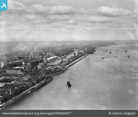
epw036377 ENGLAND (1931). The William Wright Dock, the Albert Dock and the River Humber, Kingston upon Hull, from the south, 1931
© Copyright OpenStreetMap contributors and licensed by the OpenStreetMap Foundation. 2025. Cartography is licensed as CC BY-SA.
Nearby Images (5)
EPW036377

EPW036420

EPW036384

EAW046148

EPW055049

Details
| Title | [EPW036377] The William Wright Dock, the Albert Dock and the River Humber, Kingston upon Hull, from the south, 1931 |
| Reference | EPW036377 |
| Date | August-1931 |
| Link | |
| Place name | KINGSTON UPON HULL |
| Parish | |
| District | |
| Country | ENGLAND |
| Easting / Northing | 508041, 427045 |
| Longitude / Latitude | -0.36218305687979, 53.728374767796 |
| National Grid Reference | TA080270 |
Pins
 John Wass |
Tuesday 4th of July 2017 03:43:23 PM |