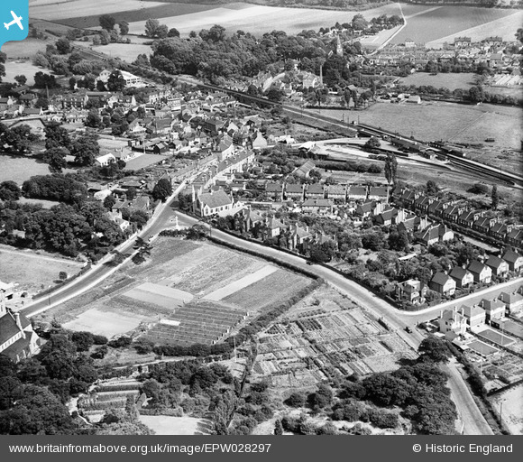
epw028297 ENGLAND (1929). Hurst Road, Old Bexley, 1929
© Copyright OpenStreetMap contributors and licensed by the OpenStreetMap Foundation. 2024. Cartography is licensed as CC BY-SA.
Details
| Title | [EPW028297] Hurst Road, Old Bexley, 1929 |
| Reference | EPW028297 |
| Date | August-1929 |
| Link | |
| Place name | OLD BEXLEY |
| Parish | |
| District | |
| Country | ENGLAND |
| Easting / Northing | 549229, 173557 |
| Longitude / Latitude | 0.14741778827401, 51.440831288745 |
| National Grid Reference | TQ492736 |
Pins
 Steve Camp |
Thursday 26th of September 2019 09:02:09 AM | |
 Tom Burnham |
Sunday 26th of July 2015 10:49:07 PM | |
 Tom Burnham |
Sunday 26th of July 2015 10:38:33 PM | |
 John Wass |
Sunday 29th of March 2015 08:46:20 PM | |
 Tom Burnham |
Monday 3rd of February 2014 06:19:48 PM | |
 Tom Burnham |
Monday 3rd of February 2014 06:18:57 PM | |
Lynda Tubbs |
Tuesday 21st of January 2014 02:22:41 PM | |
Lynda Tubbs |
Tuesday 21st of January 2014 02:17:44 PM | |
- Congregational back then. |
 Tom Burnham |
Sunday 26th of July 2015 10:36:46 PM |
Lynda Tubbs |
Tuesday 21st of January 2014 02:15:22 PM | |
 Gone2Kent |
Saturday 28th of December 2013 10:05:32 PM | |
 Gone2Kent |
Saturday 20th of July 2013 08:52:50 AM |


![[EPW028297] Hurst Road, Old Bexley, 1929](http://britainfromabove.org.uk/sites/all/libraries/aerofilms-images/public/100x100/EPW/028/EPW028297.jpg)
![[EPW028301] The Congregational Church and War Memorial, Old Bexley, 1929](http://britainfromabove.org.uk/sites/all/libraries/aerofilms-images/public/100x100/EPW/028/EPW028301.jpg)
![[EPW028303] Bexleyheath Station, Old Bexley, 1929](http://britainfromabove.org.uk/sites/all/libraries/aerofilms-images/public/100x100/EPW/028/EPW028303.jpg)