
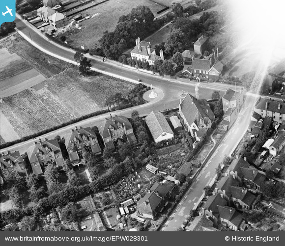
EPW028301 ENGLAND (1929). The Congregational Church and War Memorial, Old Bexley, 1929
© Copyright OpenStreetMap contributors and licensed by the OpenStreetMap Foundation. 2026. Cartography is licensed as CC BY-SA.
Nearby Images (3)
EPW028301

EPW028297

EPW028303

Details
| Title | [EPW028301] The Congregational Church and War Memorial, Old Bexley, 1929 |
| Reference | EPW028301 |
| Date | August-1929 |
| Link | |
| Place name | OLD BEXLEY |
| Parish | |
| District | |
| Country | ENGLAND |
| Easting / Northing | 549235, 173575 |
| Longitude / Latitude | 0.14751165307595, 51.440991460733 |
| National Grid Reference | TQ492736 |
Pins

Elliot |
Tuesday 20th of January 2026 06:18:40 AM | |
|
Pierre |
Saturday 11th of January 2020 12:22:07 PM | |
|
Pierre |
Saturday 11th of January 2020 12:21:04 PM | |
Lynda Tubbs |
Tuesday 21st of January 2014 02:13:47 PM |