
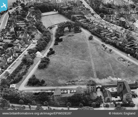
epw028187 ENGLAND (1929). Golders Green Crematorium, Golders Green, 1929
© Copyright OpenStreetMap contributors and licensed by the OpenStreetMap Foundation. 2024. Cartography is licensed as CC BY-SA.
Nearby Images (5)
EPW028187

EPW028186

EPW047880

EPW028985

EPW028172

Details
| Title | [EPW028187] Golders Green Crematorium, Golders Green, 1929 |
| Reference | EPW028187 |
| Date | July-1929 |
| Link | |
| Place name | GOLDERS GREEN |
| Parish | |
| District | |
| Country | ENGLAND |
| Easting / Northing | 525334, 187988 |
| Longitude / Latitude | -0.19110137226704, 51.576330135305 |
| National Grid Reference | TQ253880 |
Pins
Be the first to add a comment to this image!