
Scheduled Maintenance
This website will undergo scheduled maintenance on Tuesday, September 10th, between 11:00 and 15:00, as well as on Thursday, September 12th, between 10:00 and 12:00. During this time, services may be temporarily disrupted. We apologise for any inconvenience.
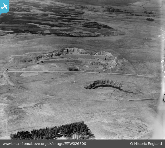
epw026800 ENGLAND (1929). Shap Blue Rock Quarry, Shap, 1929
© Copyright OpenStreetMap contributors and licensed by the OpenStreetMap Foundation. 2024. Cartography is licensed as CC BY-SA.
Nearby Images (7)
EPW026800

EPW026799

EPW026801

EPW026804

EPW026802

EPW026803

EPW026798

Details
| Title | [EPW026800] Shap Blue Rock Quarry, Shap, 1929 |
| Reference | EPW026800 |
| Date | May-1929 |
| Link | |
| Place name | SHAP |
| Parish | SHAP |
| District | |
| Country | ENGLAND |
| Easting / Northing | 356570, 510660 |
| Longitude / Latitude | -2.670508523823, 54.489284446231 |
| National Grid Reference | NY566107 |
Pins
Be the first to add a comment to this image!