
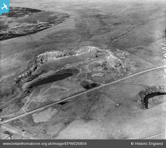
EPW026804 ENGLAND (1929). Shap Blue Rock Quarry, Shap, 1929
© Copyright OpenStreetMap contributors and licensed by the OpenStreetMap Foundation. 2025. Cartography is licensed as CC BY-SA.
Nearby Images (7)
EPW026804

EPW026802

EPW026799

EPW026798

EPW026801

EPW026800

EPW026803

Details
| Title | [EPW026804] Shap Blue Rock Quarry, Shap, 1929 |
| Reference | EPW026804 |
| Date | May-1929 |
| Link | |
| Place name | SHAP |
| Parish | SHAP |
| District | |
| Country | ENGLAND |
| Easting / Northing | 356534, 510645 |
| Longitude / Latitude | -2.6710620717578, 54.489146552307 |
| National Grid Reference | NY565106 |
Pins
Be the first to add a comment to this image!