
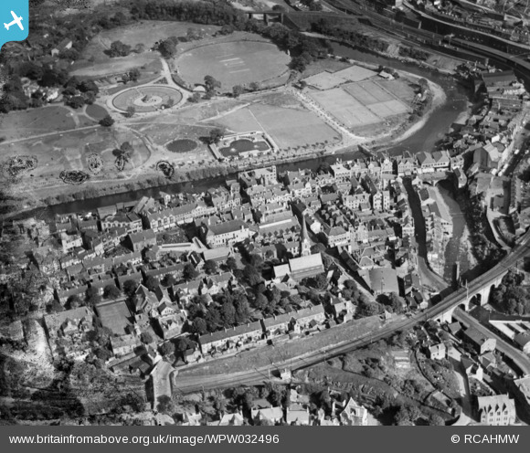
WPW032496 WALES (1930). General view of Pontypridd, showing Ynysangharad Park, oblique aerial view. 5"x4" black and white glass plate negative.
© Copyright OpenStreetMap contributors and licensed by the OpenStreetMap Foundation. 2025. Cartography is licensed as CC BY-SA.
Nearby Images (22)
WPW032420

WPW032421

WPW032422

WPW032490

WPW032491

WPW032492

WPW032493

WPW032494

WPW032495

WPW032496

WPW032518

WPW032525

WPW040013

WPW040014

WPW040015

WPW040016

WPW040017

WPW040018

WPW038318

WPW038319

WPW038320

WPW038321

Details
| Title | [WPW032496] General view of Pontypridd, showing Ynysangharad Park, oblique aerial view. 5"x4" black and white glass plate negative. |
| Reference | WPW032496 |
| Date | 1930 |
| Link | Coflein Archive Item 6370802 |
| Place name | |
| Parish | |
| District | |
| Country | WALES |
| Easting / Northing | 307270, 189900 |
| Longitude / Latitude | -3.339005185903, 51.599827197382 |
| National Grid Reference | ST073899 |
Pins
 Rob Daniels |
Sunday 20th of January 2013 12:05:59 PM | |
Alison Longman |
Tuesday 17th of July 2012 11:40:45 AM | |
 Class31 |
Tuesday 3rd of July 2012 09:59:17 AM | |
Class31 |
Tuesday 3rd of July 2012 09:56:29 AM | |
Class31 |
Tuesday 3rd of July 2012 09:55:03 AM | |
Class31 |
Tuesday 3rd of July 2012 09:54:13 AM | |
Chelsea61 |
Thursday 28th of June 2012 08:45:52 PM | |
Chelsea61 |
Thursday 28th of June 2012 08:44:12 PM |