
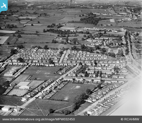
WPW032450 WALES (1930). View of Rhiwbina, oblique aerial view. 5"x4" black and white glass plate negative.
© Copyright OpenStreetMap contributors and licensed by the OpenStreetMap Foundation. 2026. Cartography is licensed as CC BY-SA.
Nearby Images (3)
WPW032449

WPW032450

WPW032451

Details
| Title | [WPW032450] View of Rhiwbina, oblique aerial view. 5"x4" black and white glass plate negative. |
| Reference | WPW032450 |
| Date | 1930 |
| Link | Coflein Archive Item 6370766 |
| Place name | |
| Parish | |
| District | |
| Country | WALES |
| Easting / Northing | 315000, 181000 |
| Longitude / Latitude | -3.2252616691561, 51.521033014733 |
| National Grid Reference | ST150810 |
Pins

G-Runner |
Saturday 13th of October 2018 07:29:42 PM | |
|
ERICA |
Friday 2nd of September 2016 07:07:41 PM | |
|
ERICA |
Friday 2nd of September 2016 07:05:52 PM | |
|
DMJT |
Tuesday 28th of June 2016 11:10:30 PM | |
|
DMJT |
Tuesday 28th of June 2016 11:03:20 PM | |
|
mark |
Thursday 14th of March 2013 11:35:39 PM | |
|
ERICA |
Saturday 9th of March 2013 03:07:22 PM | |
|
Cardiff Steve |
Saturday 7th of July 2012 11:45:44 AM | |
|
ERICA |
Saturday 30th of June 2012 03:09:22 PM |
User Comment Contributions
Image is of Rhiwbina, Cardiff. Rhiwbina garden village in lower half of picture. Rhiwbina recreation club at 8 o'clock and junior school just above and to left. |
Cardiff Steve |
Saturday 7th of July 2012 11:49:02 AM |
This is a view of Rhiwbina not Whitchurch |
HPSauce |
Friday 29th of June 2012 10:08:43 PM |