
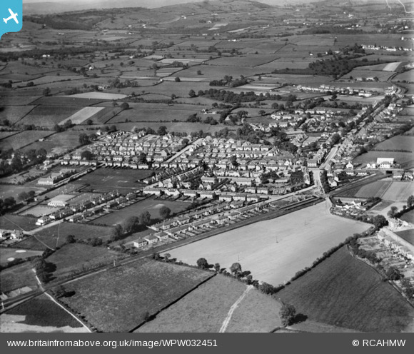
WPW032451 WALES (1930). View of Rhiwbina, oblique aerial view. 5"x4" black and white glass plate negative.
© Copyright OpenStreetMap contributors and licensed by the OpenStreetMap Foundation. 2026. Cartography is licensed as CC BY-SA.
Nearby Images (3)
WPW032449

WPW032450

WPW032451

Details
| Title | [WPW032451] View of Rhiwbina, oblique aerial view. 5"x4" black and white glass plate negative. |
| Reference | WPW032451 |
| Date | 1930 |
| Link | Coflein Archive Item 6370767 |
| Place name | |
| Parish | |
| District | |
| Country | WALES |
| Easting / Northing | 315000, 181000 |
| Longitude / Latitude | -3.2252616691561, 51.521033014733 |
| National Grid Reference | ST150810 |
Pins

IanGardiner |
Sunday 14th of February 2021 09:25:38 PM | |
|
Chris G |
Saturday 11th of April 2020 05:20:46 PM | |
|
DMJT |
Friday 3rd of February 2017 01:53:07 PM | |
|
DMJT |
Tuesday 28th of June 2016 11:11:45 PM | |

Class31 |
Monday 28th of July 2014 02:16:15 PM | |
|
Class31 |
Monday 28th of July 2014 02:13:46 PM | |
|
joe |
Saturday 13th of October 2012 09:20:32 PM | |
|
joe |
Saturday 13th of October 2012 09:17:53 PM | |
|
Louis |
Friday 20th of July 2012 08:41:56 PM | |
|
HPSauce |
Wednesday 27th of June 2012 06:39:42 PM | |
|
HPSauce |
Wednesday 27th of June 2012 06:35:50 PM | |
|
HPSauce |
Wednesday 27th of June 2012 06:34:53 PM | |
|
HPSauce |
Wednesday 27th of June 2012 06:34:27 PM |
User Comment Contributions
This is a view of Rhiwbina not Whitchurch |
HPSauce |
Wednesday 27th of June 2012 06:36:10 PM |