
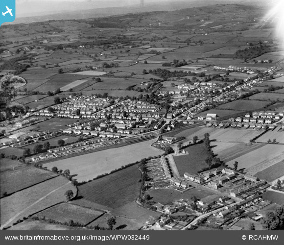
WPW032449 WALES (1930). View of Rhiwbina, oblique aerial view. 5"x4" black and white glass plate negative.
© Copyright OpenStreetMap contributors and licensed by the OpenStreetMap Foundation. 2026. Cartography is licensed as CC BY-SA.
Nearby Images (3)
WPW032449

WPW032450

WPW032451

Details
| Title | [WPW032449] View of Rhiwbina, oblique aerial view. 5"x4" black and white glass plate negative. |
| Reference | WPW032449 |
| Date | 1930 |
| Link | Coflein Archive Item 6370765 |
| Place name | |
| Parish | |
| District | |
| Country | WALES |
| Easting / Northing | 315000, 181000 |
| Longitude / Latitude | -3.2252616691561, 51.521033014733 |
| National Grid Reference | ST150810 |
Pins

IanGardiner |
Thursday 9th of July 2026 10:51:07 PM | |
|
totoro |
Monday 22nd of September 2014 05:45:47 PM | |
|
totoro |
Monday 22nd of September 2014 05:40:37 PM | |
|
totoro |
Monday 22nd of September 2014 05:40:02 PM | |
|
daio |
Wednesday 31st of October 2012 03:21:41 PM | |
|
daio |
Wednesday 31st of October 2012 03:17:54 PM | |
|
joe |
Saturday 13th of October 2012 09:36:00 PM | |
|
joe |
Saturday 13th of October 2012 09:34:05 PM | |
|
joe |
Saturday 13th of October 2012 09:33:02 PM | |
|
joe |
Saturday 13th of October 2012 09:31:43 PM | |
|
joe |
Saturday 13th of October 2012 09:30:33 PM | |
I think thats tyn y parc farm |
daio |
Monday 22nd of September 2014 05:00:51 PM |
I believe that Ty'n-y-Parc Farm is off the image to the right. |
totoro |
Monday 22nd of September 2014 05:51:44 PM |
|
joe |
Saturday 13th of October 2012 09:28:58 PM | |
glan y nant farm formerly forlan farm |
daio |
Monday 22nd of September 2014 04:57:23 PM |
I agree, Glan-y-Nant is to the left of the brook. Tyn y Park is well off to the right, to the right of where the former footpath (here a road) runs from Ty'n-y-cae to Ty'n-y-Parc Road. |
totoro |
Monday 22nd of September 2014 05:48:04 PM |
|
joe |
Saturday 13th of October 2012 09:27:51 PM | |
|
joe |
Saturday 13th of October 2012 09:27:15 PM | |
|
joe |
Saturday 13th of October 2012 09:25:30 PM | |
|
ERICA |
Saturday 30th of June 2012 03:01:13 PM | |
|
ERICA |
Saturday 30th of June 2012 02:59:37 PM | |
|
Griff |
Monday 25th of June 2012 09:27:05 PM |