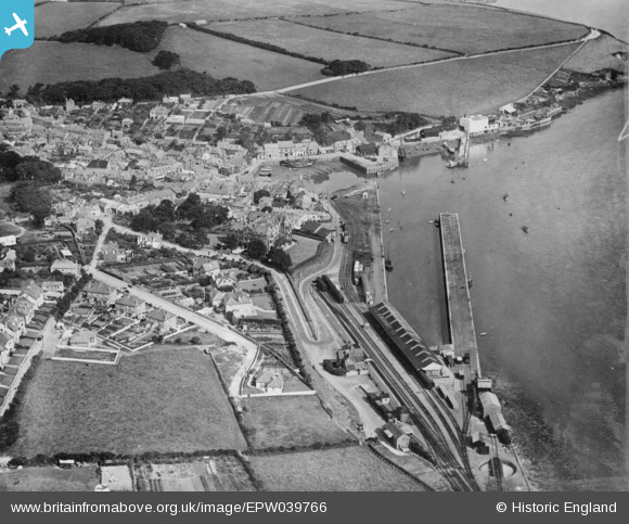
EPW039766 ENGLAND (1932). The railway station and harbour, Padstow, 1932. This image has been produced from a copy-negative.
© Copyright OpenStreetMap contributors and licensed by the OpenStreetMap Foundation. 2025. Cartography is licensed as CC BY-SA.
Nearby Images (5)
Details
| Title | [EPW039766] The railway station and harbour, Padstow, 1932. This image has been produced from a copy-negative. |
| Reference | EPW039766 |
| Date | August-1932 |
| Link | |
| Place name | PADSTOW |
| Parish | PADSTOW |
| District | |
| Country | ENGLAND |
| Easting / Northing | 192002, 75255 |
| Longitude / Latitude | -4.9357815618898, 50.53942842809 |
| National Grid Reference | SW920753 |
Pins
Be the first to add a comment to this image!


![[EPW039766] The railway station and harbour, Padstow, 1932. This image has been produced from a copy-negative.](http://britainfromabove.org.uk/sites/all/libraries/aerofilms-images/public/100x100/EPW/039/EPW039766.jpg)
![[EPW039764] The harbour and the town, Padstow, 1932](http://britainfromabove.org.uk/sites/all/libraries/aerofilms-images/public/100x100/EPW/039/EPW039764.jpg)
![[EPW033002] The railway terminus, harbour and town, Padstow, from the south-east, 1930](http://britainfromabove.org.uk/sites/all/libraries/aerofilms-images/public/100x100/EPW/033/EPW033002.jpg)
![[EPW033142] The harbour and town, Padstow, 1930](http://britainfromabove.org.uk/sites/all/libraries/aerofilms-images/public/100x100/EPW/033/EPW033142.jpg)
![[EPW033141] The harbour and town, Padstow, 1930](http://britainfromabove.org.uk/sites/all/libraries/aerofilms-images/public/100x100/EPW/033/EPW033141.jpg)