
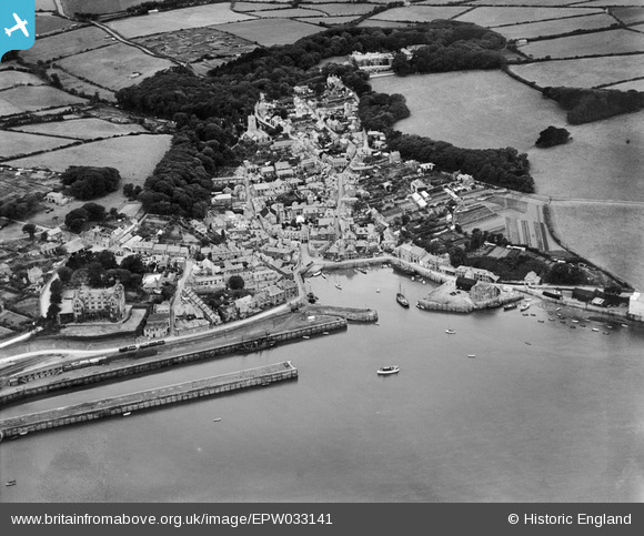
EPW033141 ENGLAND (1930). The harbour and town, Padstow, 1930
© Copyright OpenStreetMap contributors and licensed by the OpenStreetMap Foundation. 2026. Cartography is licensed as CC BY-SA.
Nearby Images (4)
EPW033141

EPW033142

EPW039764

EPW039766

Details
| Title | [EPW033141] The harbour and town, Padstow, 1930 |
| Reference | EPW033141 |
| Date | July-1930 |
| Link | |
| Place name | PADSTOW |
| Parish | PADSTOW |
| District | |
| Country | ENGLAND |
| Easting / Northing | 191886, 75413 |
| Longitude / Latitude | -4.9375047785775, 50.540806342639 |
| National Grid Reference | SW919754 |
Pins
Be the first to add a comment to this image!