
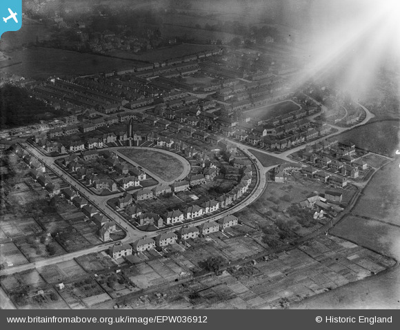
EPW036912 ENGLAND (1931). New housing at Watling Crescent, Handbridge, 1931
© Copyright OpenStreetMap contributors and licensed by the OpenStreetMap Foundation. 2025. Cartography is licensed as CC BY-SA.
Nearby Images (7)
EPW036912

EPW037239

EPW058004

EPW037237

EPW037238

EPW037236

EPW036911

Details
| Title | [EPW036912] New housing at Watling Crescent, Handbridge, 1931 |
| Reference | EPW036912 |
| Date | September-1931 |
| Link | |
| Place name | HANDBRIDGE |
| Parish | |
| District | |
| Country | ENGLAND |
| Easting / Northing | 341057, 365123 |
| Longitude / Latitude | -2.8820594537035, 53.179652799198 |
| National Grid Reference | SJ411651 |
Pins
Be the first to add a comment to this image!