
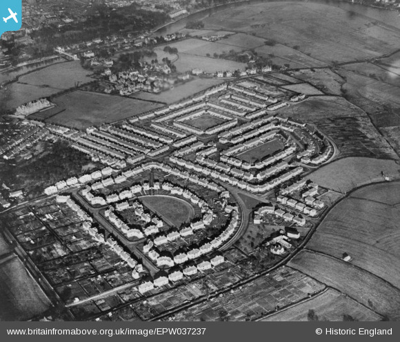
EPW037237 ENGLAND (1931). The residential area at Handbridge, Chester, 1931. This image has been produced from a copy-negative.
© Copyright OpenStreetMap contributors and licensed by the OpenStreetMap Foundation. 2026. Cartography is licensed as CC BY-SA.
Nearby Images (7)
EPW037237

EPW037238

EPW037236

EPW036911

EPW058004

EPW037239

EPW036912

Details
| Title | [EPW037237] The residential area at Handbridge, Chester, 1931. This image has been produced from a copy-negative. |
| Reference | EPW037237 |
| Date | November-1931 |
| Link | |
| Place name | CHESTER |
| Parish | |
| District | |
| Country | ENGLAND |
| Easting / Northing | 341138, 365254 |
| Longitude / Latitude | -2.8808716022605, 53.180839310177 |
| National Grid Reference | SJ411653 |
Pins
Be the first to add a comment to this image!