
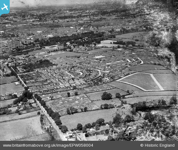
EPW058004 ENGLAND (1938). Housing estate at Handbridge, Chester, 1938. This image has been produced from a damaged negative.
© Copyright OpenStreetMap contributors and licensed by the OpenStreetMap Foundation. 2026. Cartography is licensed as CC BY-SA.
Nearby Images (7)
EPW058004

EPW037239

EPW036912

EPW037237

EPW037238

EPW037236

EPW036911

Details
| Title | [EPW058004] Housing estate at Handbridge, Chester, 1938. This image has been produced from a damaged negative. |
| Reference | EPW058004 |
| Date | 18-July-1938 |
| Link | |
| Place name | CHESTER |
| Parish | |
| District | |
| Country | ENGLAND |
| Easting / Northing | 341077, 365169 |
| Longitude / Latitude | -2.8817686803504, 53.180068503014 |
| National Grid Reference | SJ411652 |
Pins

MILLSY |
Sunday 29th of November 2020 08:49:09 PM | |
|
totoro |
Saturday 15th of June 2013 08:27:22 PM | |
|
totoro |
Saturday 15th of June 2013 08:25:43 PM | |
|
totoro |
Saturday 15th of June 2013 08:23:33 PM | |
|
totoro |
Saturday 15th of June 2013 08:22:53 PM | |
|
totoro |
Saturday 15th of June 2013 08:21:49 PM | |
|
totoro |
Saturday 15th of June 2013 08:20:53 PM | |
|
totoro |
Saturday 15th of June 2013 08:19:58 PM | |
|
totoro |
Saturday 15th of June 2013 08:19:26 PM | |
|
totoro |
Saturday 15th of June 2013 08:18:52 PM | |
|
totoro |
Saturday 15th of June 2013 08:18:02 PM | |
|
totoro |
Saturday 15th of June 2013 07:17:20 PM | |
|
totoro |
Saturday 15th of June 2013 07:16:11 PM | |
|
totoro |
Saturday 15th of June 2013 07:15:42 PM |