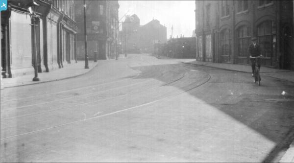
EPW036536 ENGLAND (1931). The River Hull and the city, Kingston upon Hull, 1931

© Copyright OpenStreetMap contributors and licensed by the OpenStreetMap Foundation. 2025. Cartography is licensed as CC BY-SA.
Nearby Images (18)
EPW036536

EPW012694

EAW010318

EAW010312

EAW010317

EAW010315

EAW010311

EAW010316

EAW010309

EAW010313

EAW010310

EAW010319

EAW010314

EPW053411

EPW053407

EPW053410

EPW053412

EPW053413

Details
| Title | [EPW036536] The River Hull and the city, Kingston upon Hull, 1931 |
| Reference | EPW036536 |
| Date | August-1931 |
| Link | |
| Place name | KINGSTON UPON HULL |
| Parish | |
| District | |
| Country | ENGLAND |
| Easting / Northing | 510076, 429778 |
| Longitude / Latitude | -0.33037500855949, 53.752506058236 |
| National Grid Reference | TA101298 |
Pins
 ladyceecee |
Thursday 16th of November 2023 03:55:50 PM | |
ladyceecee |
Thursday 16th of November 2023 03:50:53 PM | |
Mark |
Wednesday 11th of March 2020 01:02:40 PM | |
Val |
Sunday 15th of January 2017 01:05:30 PM | |
CartoonHead |
Tuesday 10th of November 2015 08:41:36 PM | |
CartoonHead |
Tuesday 10th of November 2015 08:32:52 PM | |
CartoonHead |
Tuesday 10th of November 2015 08:32:22 PM | |
Sharmo |
Saturday 21st of February 2015 06:24:54 PM | |
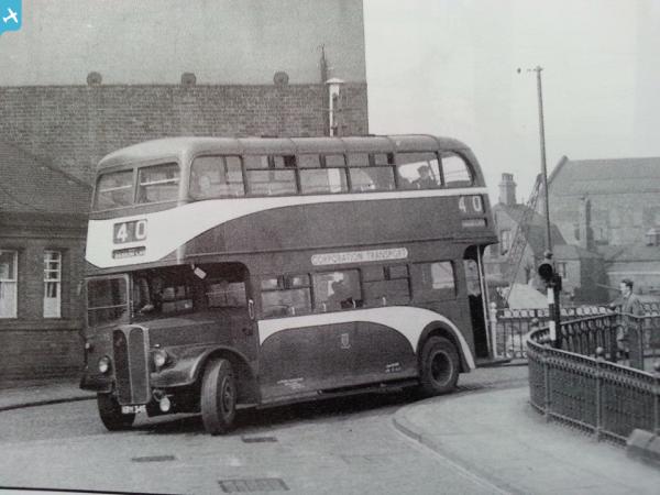
Excellent photo! But what was the No 40 doing going over Scott St bridge? |
Mac |
Wednesday 9th of December 2015 07:45:34 PM |
Not an ideal route for buses, maybe north bridge was closed at the time |
CartoonHead |
Tuesday 29th of December 2015 03:45:52 PM |
John Wass |
Friday 4th of July 2014 12:25:00 PM | |
John Wass |
Wednesday 18th of June 2014 08:30:20 PM | |
John Wass |
Wednesday 18th of June 2014 08:29:42 PM | |
John Wass |
Wednesday 18th of June 2014 08:26:58 PM | |
 Dylan Moore |
Monday 10th of December 2012 10:29:50 PM |