
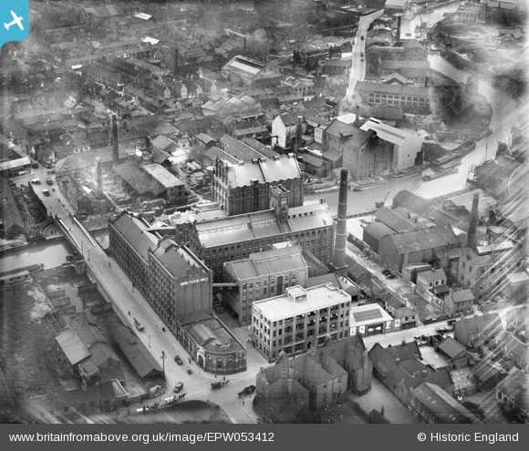
EPW053412 ENGLAND (1937). Swan Flour Mills, Sculcoates Bridge and environs, Kingston upon Hull, 1937
© Copyright OpenStreetMap contributors and licensed by the OpenStreetMap Foundation. 2026. Cartography is licensed as CC BY-SA.
Nearby Images (23)
EPW053412

EPW053409

EPW053413

EPW053410

EPW053407

EPW053411

EAW010314

EAW010313

EAW010319

EAW010320

EAW010311

EAW010310

EAW010317

EAW010312

EAW010315

EAW010318

EAW010316

EAW010309

EPW036523

EPW036531

EPW009397

EPW012694

EPW036536

Details
| Title | [EPW053412] Swan Flour Mills, Sculcoates Bridge and environs, Kingston upon Hull, 1937 |
| Reference | EPW053412 |
| Date | 31-May-1937 |
| Link | |
| Place name | KINGSTON UPON HULL |
| Parish | |
| District | |
| Country | ENGLAND |
| Easting / Northing | 510322, 430002 |
| Longitude / Latitude | -0.32656543222901, 53.754466734158 |
| National Grid Reference | TA103300 |
Pins
Be the first to add a comment to this image!