
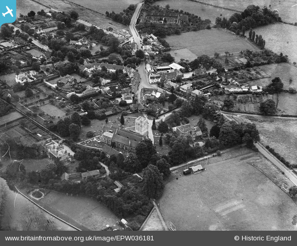
EPW036181 ENGLAND (1931). St Michael's Church and the village centre, Bray, 1931
© Copyright OpenStreetMap contributors and licensed by the OpenStreetMap Foundation. 2025. Cartography is licensed as CC BY-SA.
Nearby Images (11)
EPW036181

EPW022614

EPW022615

EAW056568

EAW003808

EPW036182

EPW022616

EPW036186

EPW000908

EPW036183

EAW003807

Details
| Title | [EPW036181] St Michael's Church and the village centre, Bray, 1931 |
| Reference | EPW036181 |
| Date | August-1931 |
| Link | |
| Place name | BRAY |
| Parish | BRAY |
| District | |
| Country | ENGLAND |
| Easting / Northing | 490163, 179652 |
| Longitude / Latitude | -0.70067938779893, 51.508113488743 |
| National Grid Reference | SU902797 |
Pins
Be the first to add a comment to this image!