
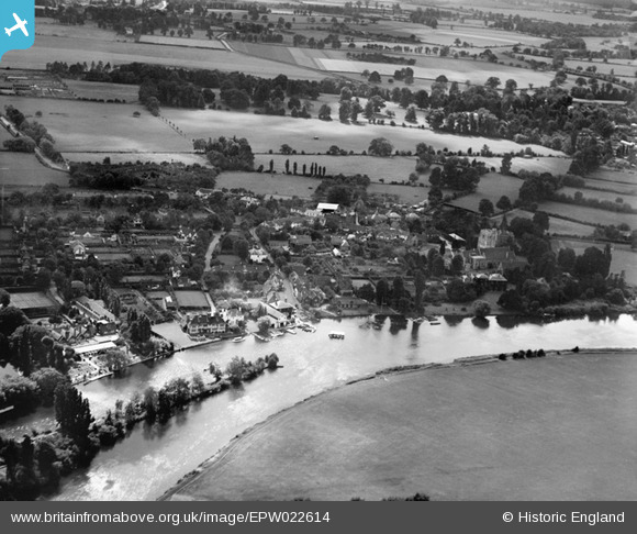
EPW022614 ENGLAND (1928). The village and the River Thames, Bray, 1928
© Copyright OpenStreetMap contributors and licensed by the OpenStreetMap Foundation. 2026. Cartography is licensed as CC BY-SA.
Nearby Images (9)
EPW022614

EPW036181

EAW056568

EPW022615

EPW022616

EAW003807

EAW003808

EPW022617

EPW036185

Details
| Title | [EPW022614] The village and the River Thames, Bray, 1928 |
| Reference | EPW022614 |
| Date | 11-August-1928 |
| Link | |
| Place name | BRAY |
| Parish | BRAY |
| District | |
| Country | ENGLAND |
| Easting / Northing | 490257, 179618 |
| Longitude / Latitude | -0.69933385299332, 51.507792812657 |
| National Grid Reference | SU903796 |
Pins
Be the first to add a comment to this image!