
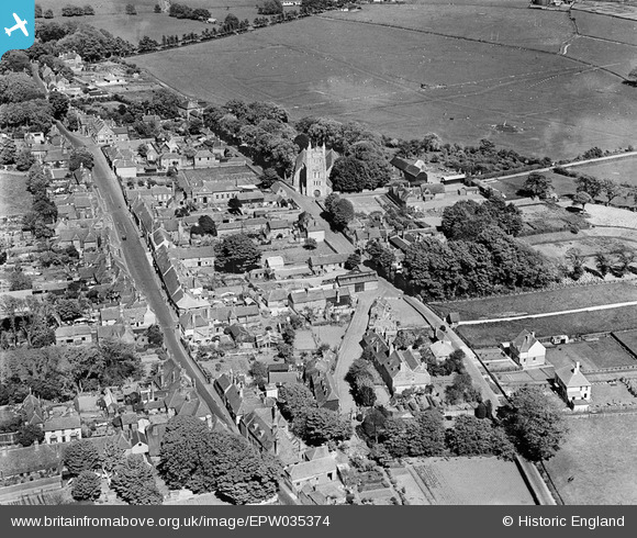
EPW035374 ENGLAND (1931). St Nicholas's Church and the town centre, New Romney, 1931
© Copyright OpenStreetMap contributors and licensed by the OpenStreetMap Foundation. 2025. Cartography is licensed as CC BY-SA.
Nearby Images (3)
EPW035374

EPW035372

EPW035373

Details
| Title | [EPW035374] St Nicholas's Church and the town centre, New Romney, 1931 |
| Reference | EPW035374 |
| Date | 25-May-1931 |
| Link | |
| Place name | NEW ROMNEY |
| Parish | NEW ROMNEY |
| District | |
| Country | ENGLAND |
| Easting / Northing | 606420, 124723 |
| Longitude / Latitude | 0.94128680442064, 50.984303919057 |
| National Grid Reference | TR064247 |
Pins

Mike Floate |
Sunday 3rd of August 2014 04:43:43 PM |