
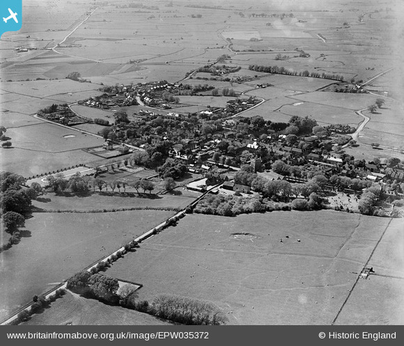
EPW035372 ENGLAND (1931). The town, New Romney, 1931
© Copyright OpenStreetMap contributors and licensed by the OpenStreetMap Foundation. 2025. Cartography is licensed as CC BY-SA.
Nearby Images (2)
EPW035372

EPW035374

Details
| Title | [EPW035372] The town, New Romney, 1931 |
| Reference | EPW035372 |
| Date | 25-May-1931 |
| Link | |
| Place name | NEW ROMNEY |
| Parish | NEW ROMNEY |
| District | |
| Country | ENGLAND |
| Easting / Northing | 606451, 124702 |
| Longitude / Latitude | 0.94171597143578, 50.984104192977 |
| National Grid Reference | TR065247 |
Pins
Be the first to add a comment to this image!