
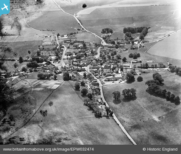
EPW032474 ENGLAND (1930). The village, East Ilsley, 1930
© Copyright OpenStreetMap contributors and licensed by the OpenStreetMap Foundation. 2025. Cartography is licensed as CC BY-SA.
Nearby Images (3)
EPW032474

EPW032475

EPW032476

Details
| Title | [EPW032474] The village, East Ilsley, 1930 |
| Reference | EPW032474 |
| Date | June-1930 |
| Link | |
| Place name | EAST ILSLEY |
| Parish | EAST ILSLEY |
| District | |
| Country | ENGLAND |
| Easting / Northing | 449291, 181213 |
| Longitude / Latitude | -1.2893901363145, 51.527194854975 |
| National Grid Reference | SU493812 |
Pins

Andy from Abingdon on Thames |
Saturday 26th of August 2017 11:10:28 PM | |
|
EastMarple1 |
Sunday 3rd of March 2013 02:28:34 AM | |
|
EastMarple1 |
Sunday 3rd of March 2013 02:20:30 AM | |
|
EastMarple1 |
Sunday 3rd of March 2013 02:19:16 AM | |
|
EastMarple1 |
Sunday 3rd of March 2013 02:18:37 AM | |
|
EastMarple1 |
Sunday 3rd of March 2013 02:17:08 AM | |
|
EastMarple1 |
Sunday 3rd of March 2013 02:16:25 AM | |
|
EastMarple1 |
Sunday 3rd of March 2013 02:15:37 AM | |
|
EastMarple1 |
Sunday 3rd of March 2013 02:12:34 AM | |
|
EastMarple1 |
Sunday 3rd of March 2013 02:11:39 AM | |
|
EastMarple1 |
Sunday 3rd of March 2013 02:10:19 AM |
