
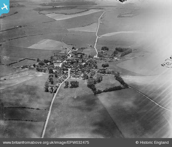
EPW032475 ENGLAND (1930). The village and surrounding countryside, East Ilsley, 1930. This image has been affected by flare.
© Copyright OpenStreetMap contributors and licensed by the OpenStreetMap Foundation. 2025. Cartography is licensed as CC BY-SA.
Nearby Images (3)
EPW032475

EPW032474

EPW032476

Details
| Title | [EPW032475] The village and surrounding countryside, East Ilsley, 1930. This image has been affected by flare. |
| Reference | EPW032475 |
| Date | June-1930 |
| Link | |
| Place name | EAST ILSLEY |
| Parish | EAST ILSLEY |
| District | |
| Country | ENGLAND |
| Easting / Northing | 449223, 181183 |
| Longitude / Latitude | -1.2903745794428, 51.526931034988 |
| National Grid Reference | SU492812 |
Pins

Andy from Abingdon on Thames |
Saturday 26th of August 2017 11:34:47 PM | |
 |
Andy from Abingdon on Thames |
Saturday 26th of August 2017 11:30:31 PM |
|
Andy from Abingdon on Thames |
Saturday 26th of August 2017 11:22:42 PM | |
|
Andy from Abingdon on Thames |
Saturday 26th of August 2017 11:21:37 PM | |
|
Andy from Abingdon on Thames |
Saturday 26th of August 2017 11:17:38 PM |
