
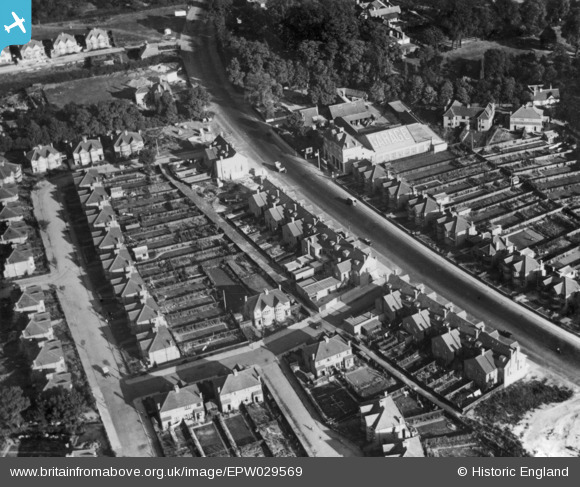
EPW029569 ENGLAND (1929). Kenton Park Parade and environs, Kenton, 1929. This image has been produced from a print.
© Copyright OpenStreetMap contributors and licensed by the OpenStreetMap Foundation. 2025. Cartography is licensed as CC BY-SA.
Nearby Images (3)
EPW029569

EPW029566

EPW029570

Details
| Title | [EPW029569] Kenton Park Parade and environs, Kenton, 1929. This image has been produced from a print. |
| Reference | EPW029569 |
| Date | September-1929 |
| Link | |
| Place name | KENTON |
| Parish | |
| District | |
| Country | ENGLAND |
| Easting / Northing | 517621, 188955 |
| Longitude / Latitude | -0.30204188071935, 51.586684459719 |
| National Grid Reference | TQ176890 |
Pins

The Laird |
Thursday 29th of March 2018 06:06:33 PM | |
|
The Laird |
Thursday 29th of March 2018 06:03:22 PM | |
|
The Laird |
Monday 23rd of November 2015 07:15:24 PM | |
|
The Laird |
Saturday 21st of March 2015 06:58:40 PM | |
|
The Laird |
Saturday 21st of March 2015 02:15:34 PM | |

Class31 |
Monday 3rd of November 2014 01:50:50 PM | |
This was Kenton Park Garage next door to the old Plough public house. |
The Laird |
Saturday 21st of March 2015 02:01:45 PM |