
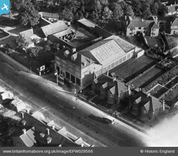
EPW029566 ENGLAND (1929). A garage on Kenton Road, Kenton, 1929. This image has been produced from a print affected by flare.
© Copyright OpenStreetMap contributors and licensed by the OpenStreetMap Foundation. 2025. Cartography is licensed as CC BY-SA.
Nearby Images (3)
EPW029566

EPW029570

EPW029569

Details
| Title | [EPW029566] A garage on Kenton Road, Kenton, 1929. This image has been produced from a print affected by flare. |
| Reference | EPW029566 |
| Date | September-1929 |
| Link | |
| Place name | KENTON |
| Parish | |
| District | |
| Country | ENGLAND |
| Easting / Northing | 517639, 188937 |
| Longitude / Latitude | -0.30178819197141, 51.586518909886 |
| National Grid Reference | TQ176889 |
Pins

The Laird |
Thursday 29th of March 2018 05:56:18 PM | |
|
The Laird |
Friday 5th of June 2015 06:56:06 PM | |
|
The Laird |
Friday 3rd of April 2015 01:58:43 PM | |
|
The Laird |
Saturday 21st of March 2015 01:57:56 PM |