
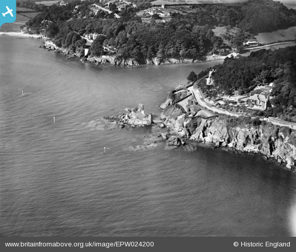
EPW024200 ENGLAND (1928). The ruins of Fort Charles and the nearby coast, Salcombe, 1928
© Copyright OpenStreetMap contributors and licensed by the OpenStreetMap Foundation. 2025. Cartography is licensed as CC BY-SA.
Nearby Images (3)
EPW024200

EPW024196

EAW007573

Details
| Title | [EPW024200] The ruins of Fort Charles and the nearby coast, Salcombe, 1928 |
| Reference | EPW024200 |
| Date | September-1928 |
| Link | |
| Place name | SALCOMBE |
| Parish | SALCOMBE |
| District | |
| Country | ENGLAND |
| Easting / Northing | 273393, 38063 |
| Longitude / Latitude | -3.7752428630842, 50.228372595995 |
| National Grid Reference | SX734381 |
Pins
Be the first to add a comment to this image!