
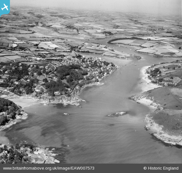
EAW007573 ENGLAND (1947). Salcombe Harbour, the town and surrounding countryside, Salcombe, from the south, 1947
© Copyright OpenStreetMap contributors and licensed by the OpenStreetMap Foundation. 2025. Cartography is licensed as CC BY-SA.
Nearby Images (3)
EAW007573

EPW024200

EPW024196

Details
| Title | [EAW007573] Salcombe Harbour, the town and surrounding countryside, Salcombe, from the south, 1947 |
| Reference | EAW007573 |
| Date | 25-June-1947 |
| Link | |
| Place name | SALCOMBE |
| Parish | SALCOMBE |
| District | |
| Country | ENGLAND |
| Easting / Northing | 273434, 37859 |
| Longitude / Latitude | -3.7746001866065, 50.226547384041 |
| National Grid Reference | SX734379 |
Pins

redmist |
Sunday 24th of July 2022 11:08:18 PM | |
|
cptpies |
Friday 2nd of August 2019 02:07:10 PM | |
|
Mickm |
Thursday 31st of December 2015 01:57:04 PM | |
|
Mickm |
Thursday 31st of December 2015 01:56:38 PM | |
|
KevinEdmunds |
Wednesday 26th of March 2014 02:29:56 PM |